The biospheres of Madagacar
The Biomes
Biomes are large and homogenous natural community of flora and fauna. Madagascar’s ecological habitats are mainly divided into three main parts: the east, the west and the south.
The biomes of Madagascar are the savannah, the desert, the tropical forest, several types of mountain ecosystems and wetlands. The savanna is a dry meadow, while the desert is extremely dry and has little vegetation. The tropical forest is mainly located in the east of Madagascar. Mountainous ecosystems are at higher altitudes. The savannah is found along the west side of the island, where most of the rains fell on the east side. The desert is also on this side of Madagascar. Tropical forests are on the opposite side of the savannah and desert biomes because most of the rains have fallen there. And finally, the mountainous ecosystems are in the middle of Madagascar, where the elevation is higher.
The terrestrial habitats comprise three major divisions:
- Primary formation
- Secondary formations
- Various crops and plantations.
Primary Formations: these formations have existed since ancient times, before any human intervention.
Two groups can be distinguished: primary forests and thickets.
The primary forests:
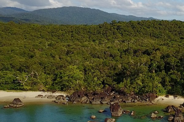
The Eastern biome
Evergreen moist forests characterize the Eastern Biomes in general. Depending on the altitude, both types exist:
- Low altitude moist evergreen forest
- High altitude moist evergreen forest
- Sclerophyllous forests grow at altitude. Two types exist:
- The sclerophyllous mid-altitude forest
- The mountain sclerophyllous forest
The Thickets
The West Biome
Dry deciduous forests dominate in the west. In this region, the forests are in an altitude range of 0 to 800 m, but they present several varieties according to the different bioclimatic types. The physiognomy of the vegetation is characterized by a height of 25m with a closed canopy and well-defined undergrowth vegetation. The formation is a mixture of three types of vegetation: evergreen, sclerophyllous and dry (on rocky outcrops).
Southern Biome
The dry forests of the Southern Ecoregion cover an area of 57,721 square kilometers and are characterized by deciduous shrubs or thorny thickets that extend south from Morombe along the coast and cover most of the southern part of Madagascar from sea level up to 400 m. Rainfall in this region is low and erratic. These are the driest forests in Madagascar and the region is commonly known as the Spiny Desert. There remain approximately 19,131 square kilometers (33%) of intact original forest in the Southern Ecoregion
The Wetland areas
The wetlands of eastern Madagascar take the form of lakes, rivers and marshes. There are few large in the region but the largest lake in the country, Alaotra Lake, is there, as well as the system of acidic and barren coastal lagoons of Pangalanes. The most important wetlands in the east are marshes, usually constructed from small marshy vegetation areas at medium and high altitude, and often located in narrow valets or on the edges of lakes.
The western wetland is shallow and often slightly alkaline. Other types are the shores and the large rivers
Malagasy coastal habitats differ considerably between the east and west of the island. The east has mostly sandy beaches sparsely populated with birds. The west is richer and more diverse with extensive mangroves, salt marshes, coastal lagoons, estuaries, sandbars, sandy beaches and offshore islands.